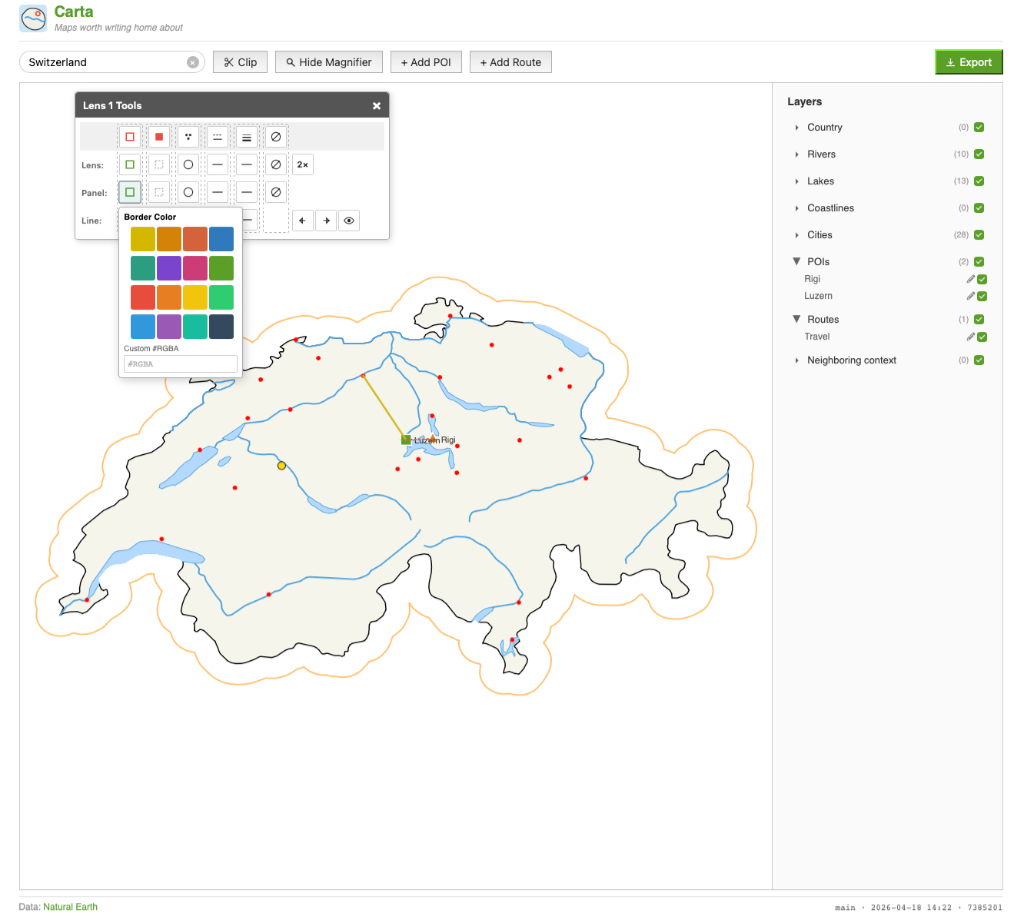
Finished (for now) my mapping tool. Check it out here.
Comments

@holgerfrohloff I use it to make “context” images of where I live for the postcards is send via Postcrossing. Show where the motive is from on the card for example. Or show the travel route I had while traveling through their country. Regarding not seeing differences after toggling cities: I see you just found a bug oO

How to respond
Write your comment on your on page and link it to this page with the following link:
https://vmac.ch/posts/2026-04-19-finished-for-now-my-mapping-1776595070/
Then insert the permalink to your post into the form below and submit it.
Alternatively you can reach me by email to: comment@vmac.ch
@V_ Congrats! what does it do? Just clicked through and tried toggling cities but couldn’t see any difference. What did you build it for?
on